News
2024-08-28
2024-08-21
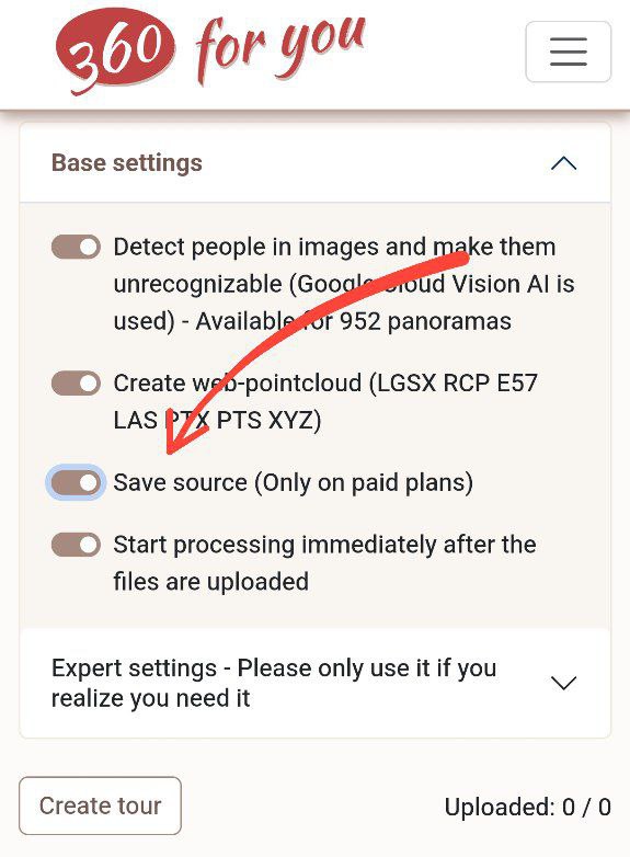
You can now save the project source files and download them if necessary via the link in the project settings. The link will work for everyone who has access to the project
2024-08-18
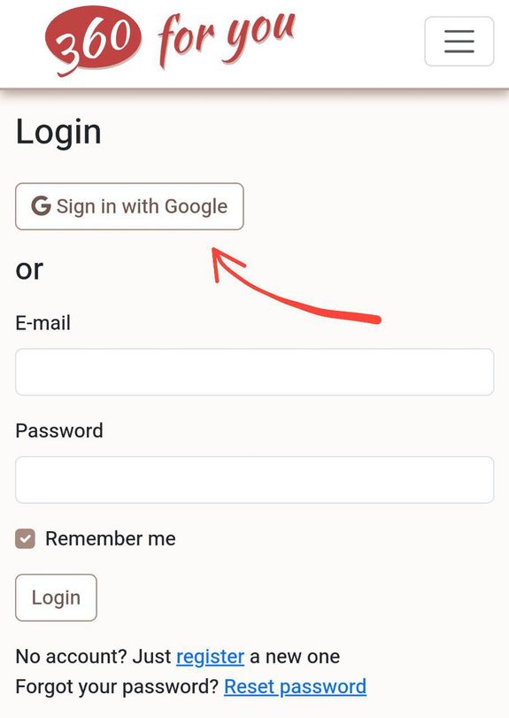
Signing up and logging into the website is now even easier with a Google account
2024-08-16
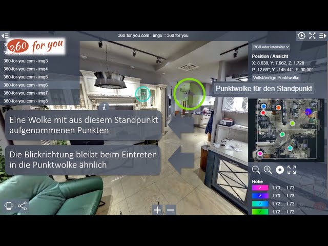
Now in the settings of any project you can set the world coordinate system and in the point cloud view mode get a map with the exact position of setups and observation point
2024-07-12
An official partnership agreement was signed with Leica Geosystems. Import of point clouds from LGSx files is available in test mode
2024-06-23

We are pleased to introduce support for Autodesk ReCap projects!
2024-06-16
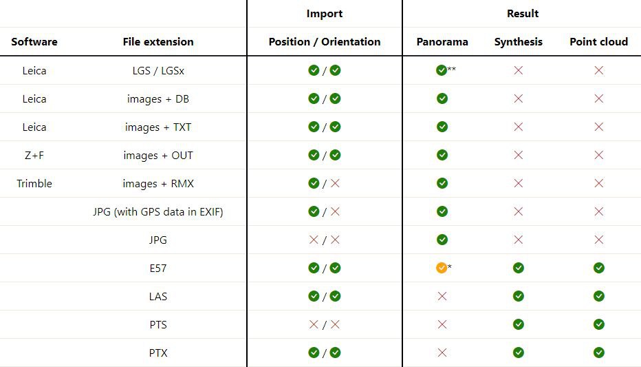
Information about supported file formats and the resulting output has been updated in the FAQ section
2024-06-14

Added ability to import PTX files
2024-05-31
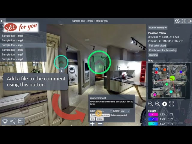
A new video about the work with comments in virtual tours is available on our channel.
2024-05-26
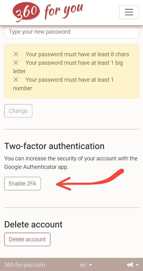
Two-factor authentication is now available for all users
2024-04-26
We have started a channel on YouTube. Subscribe to keep up with news about our service.
We will publish videos with a detailed description of the functionality of our service, which you can start using right now. We will also be sharing information about new features of the website.
Join us and stay up to date!
https://www.youtube.com/@360-for-you-com
2024-04-24
2024-04-03
2024-02-29
Do you have objects in the panorama that you want to hide? Now it's quick and easy!
2024-02-28
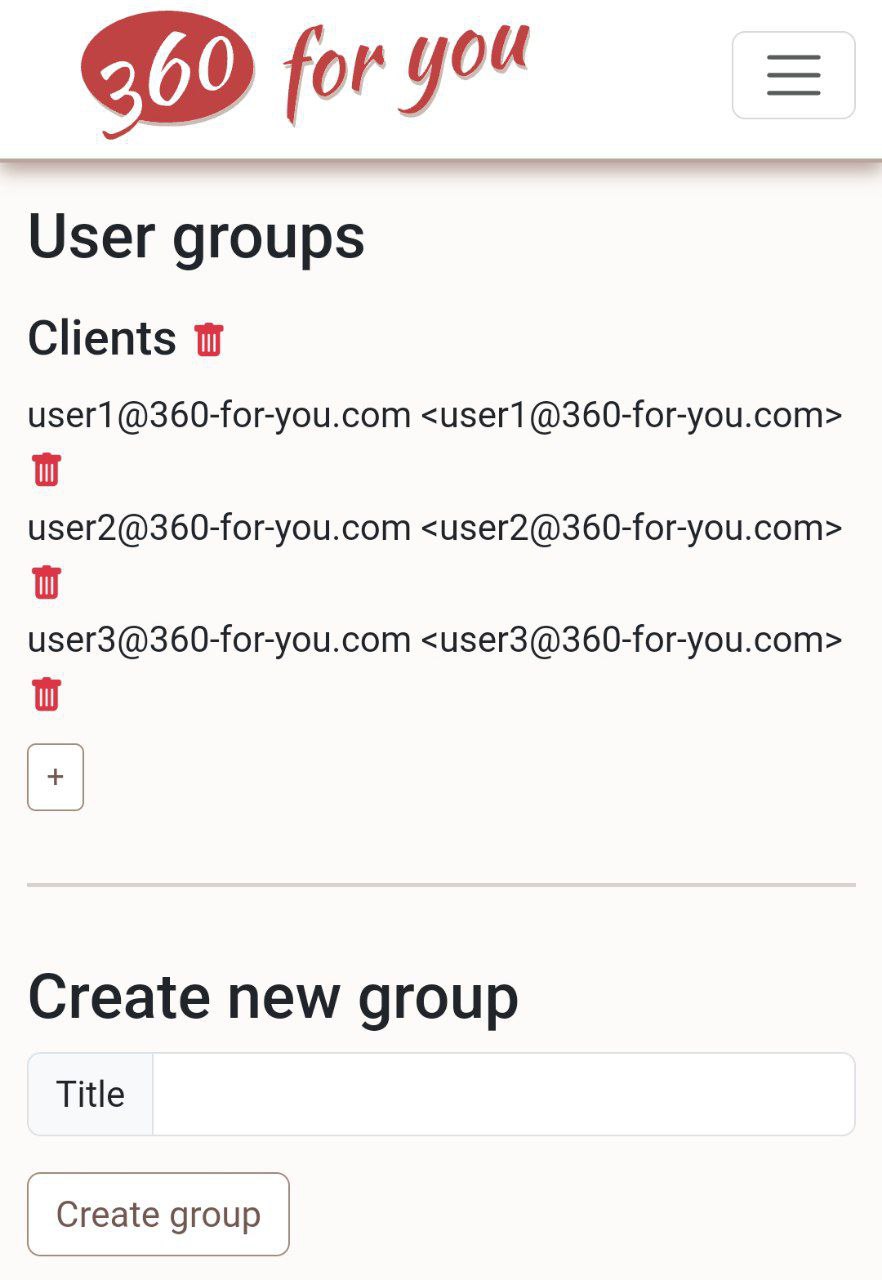
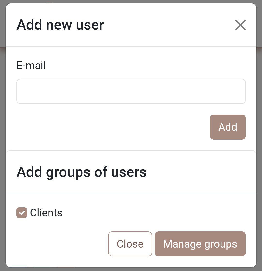
Introducing the ability to organize users into groups
2024-02-24
Now you can activate the map editing mode and easily move setups around the map
2024-02-14
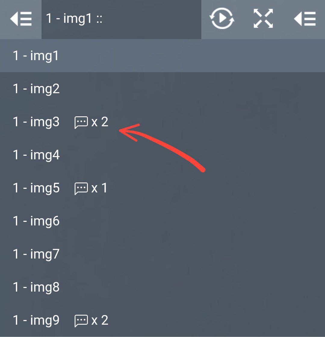
Now it will be much easier to find comments in the project
2024-02-08
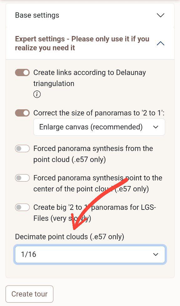
Now you can decimate your point clouds to save space and speed up browsing even more
2024-02-06

There are a lot of small changes on the website, not worthy of special attention, but one change is very important: new clouds uploaded to the website are now converted to LAZ format, which reduces the disk space occupied by 5-10 times, and the speed of rendering clouds has increased by 10-20 times. Try it and see for yourself!