News
2025-08-22

An AI Assistant is now available to answer your questions on the FAQ page
2025-07-02
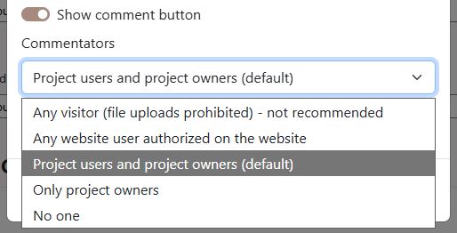
Manage the ability to comment on virtual tours with much greater flexibility
2025-06-28
Introducing our updated FAQ section
2025-06-20
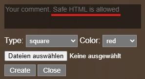
Comments in virtual tours now support HTML formatting
2025-06-19
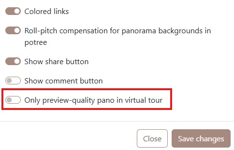
You can now enable the "Only preview-quality pano in virtual tour" option in the project settings. This feature is especially useful for contractors who prefer not to share high-resolution images until payment for their work has been received
2025-06-18

The landing page now supports HTML formatting
2025-06-15
With just a few photos taken on your insta360, you can easily put together a fully interactive virtual tour. Check out this quick tutorial to see how fast and simple it is:
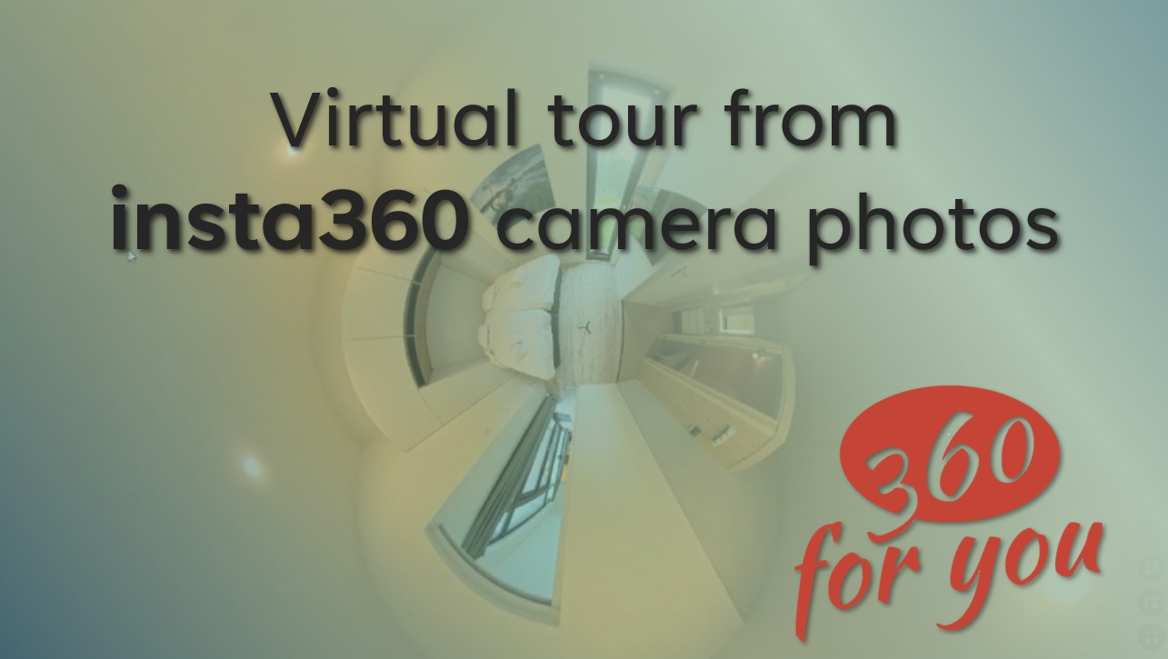
https://youtu.be/IGucR18yJM4?si=2E1MyKhxYIDJG-PD
2025-05-29
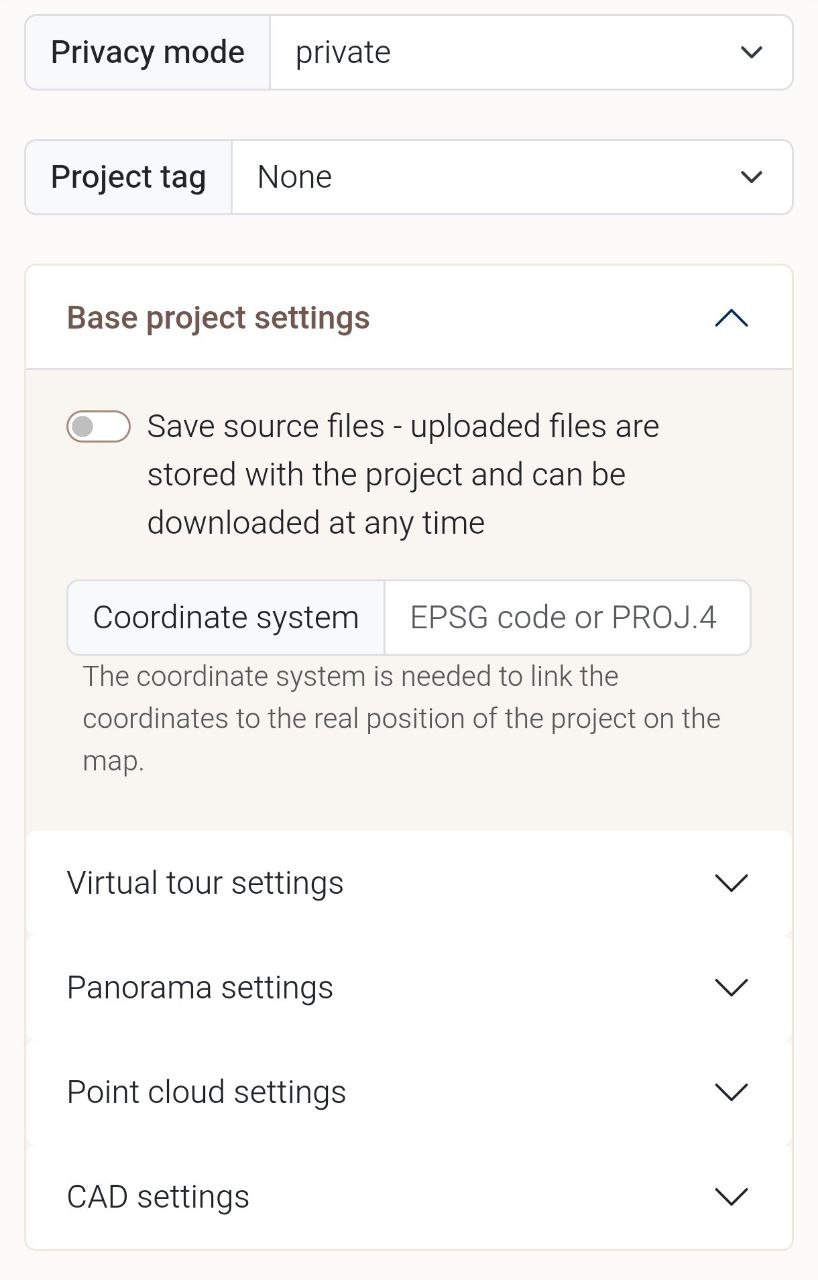
We have changed the project settings section on the upload page to make it easier for you to navigate through the ever-growing number of fine-tuning options.
2025-05-22
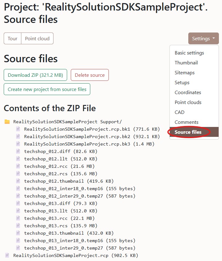
New tool for working with project source data
2025-05-07
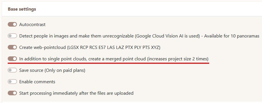
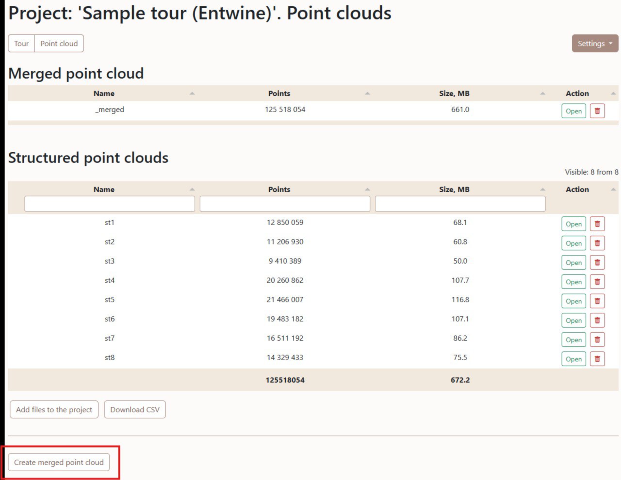
In addition to single point clouds, create a merged point cloud. For structured point clouds consisting of hundreds and sometimes thousands of setups, this option allows you to display a complete point cloud in seconds! The function is also available for existing projects
2025-04-27
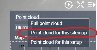
For structured point clouds, in addition to displaying all setups and one specific setup, there is now an option to display all setups belonging to the one sitemap
2025-04-10
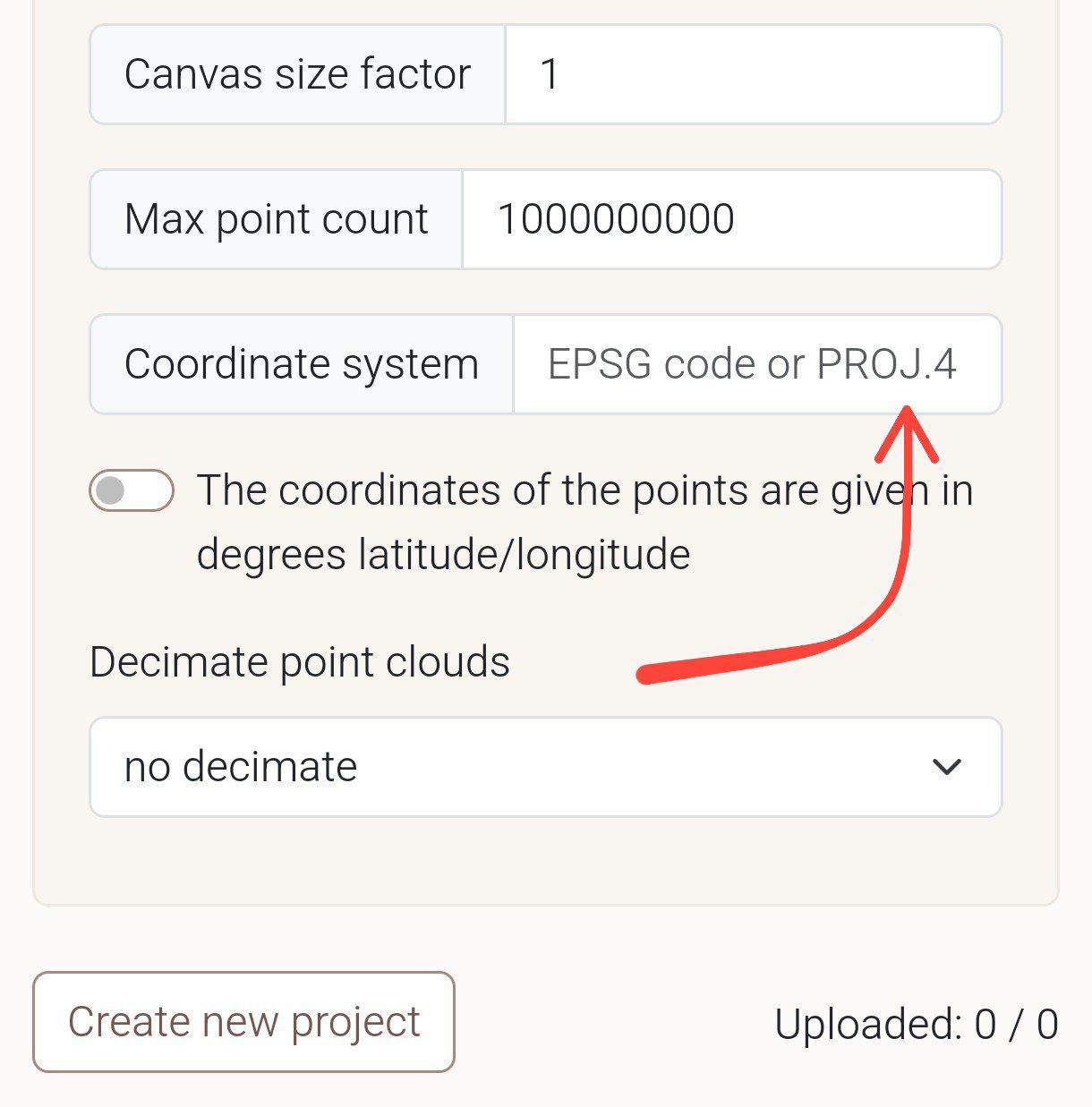
You can now use PROJ.4 strings to specify the coordinate system
2025-04-06

Today, 3604u is celebrating its 2nd anniversary, and birthdays are all about giving gifts. So we’re giving you the chance to get a 25% discount on an annual subscription with the promo code HAPPY-BIRTHDAY. The code is valid for one week
2025-03-11
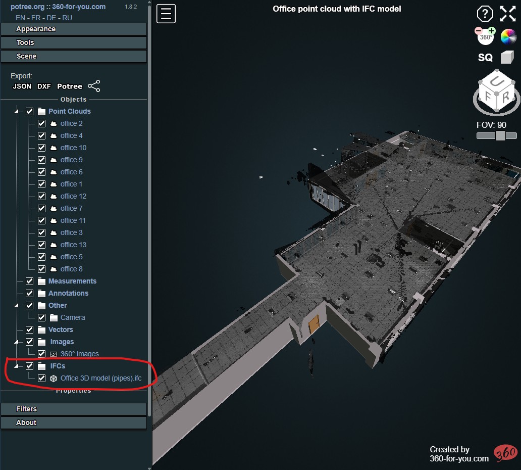
Manage the visibility of IFC models in the same way as point clouds
2025-03-07
Breaking into BIM. Host your IFC models on our website, and integrate them into the point cloud
2025-03-02

Introducing a customizable "Welcome overlay" for your projects. The text can be set in the project settings
2025-02-02
Group your projects easily and conveniently
2025-01-06
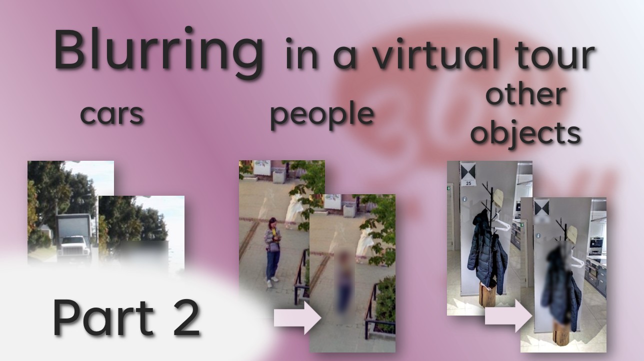
One of our key features is the ability to blur people, cars, text, and other objects that shouldn't be visible in your virtual tours. Our service offers two blurring modes: automatic, which you can enable when creating a project, and manual, for more precise editing.
Watch this video to learn how the automatic blur mode works. Blurring objects in manual mode was illustrated in one of the previous videos.
https://youtu.be/TYJEwNEkJZo?si=HwFKsoitZVZG8fKu
2024-12-23
Full screen mode for point clouds
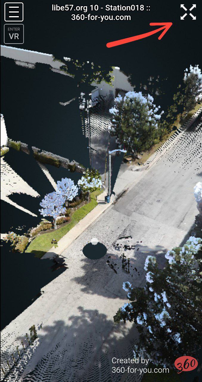
2024-12-22
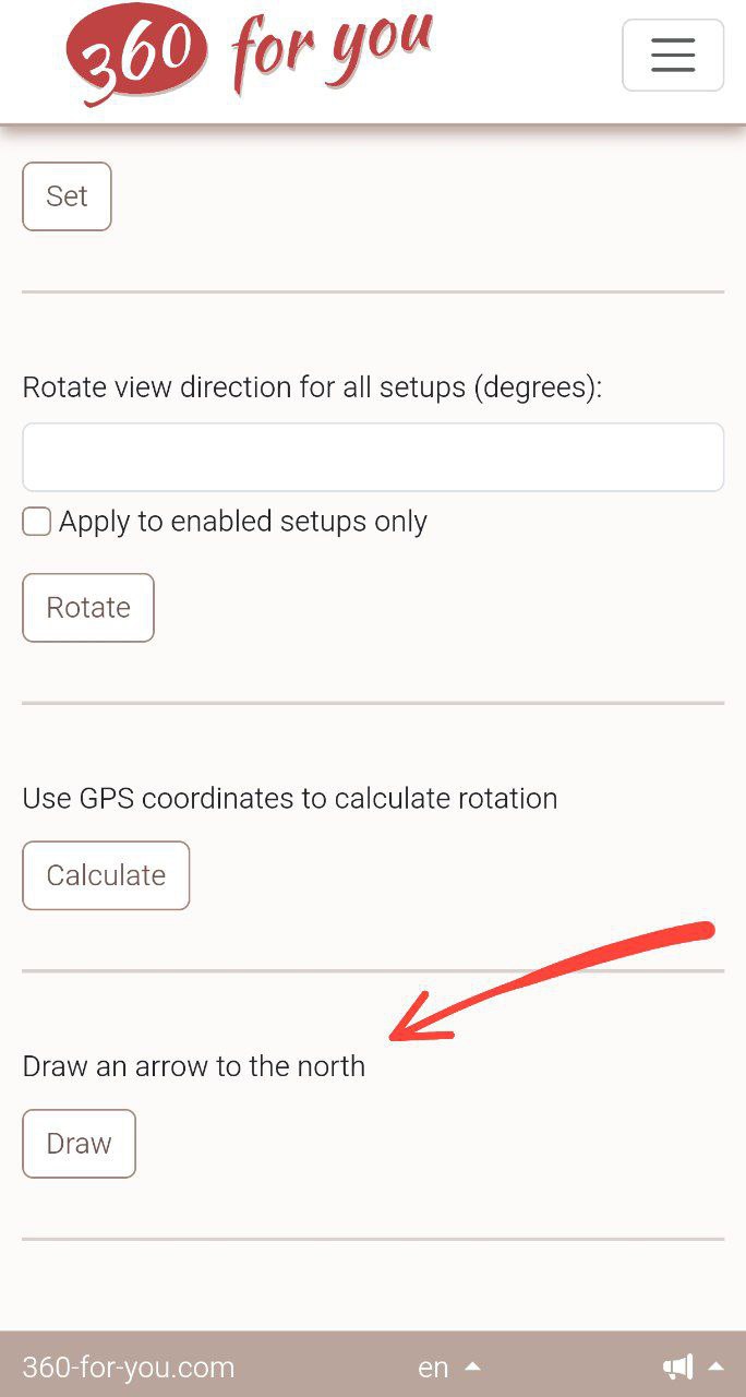
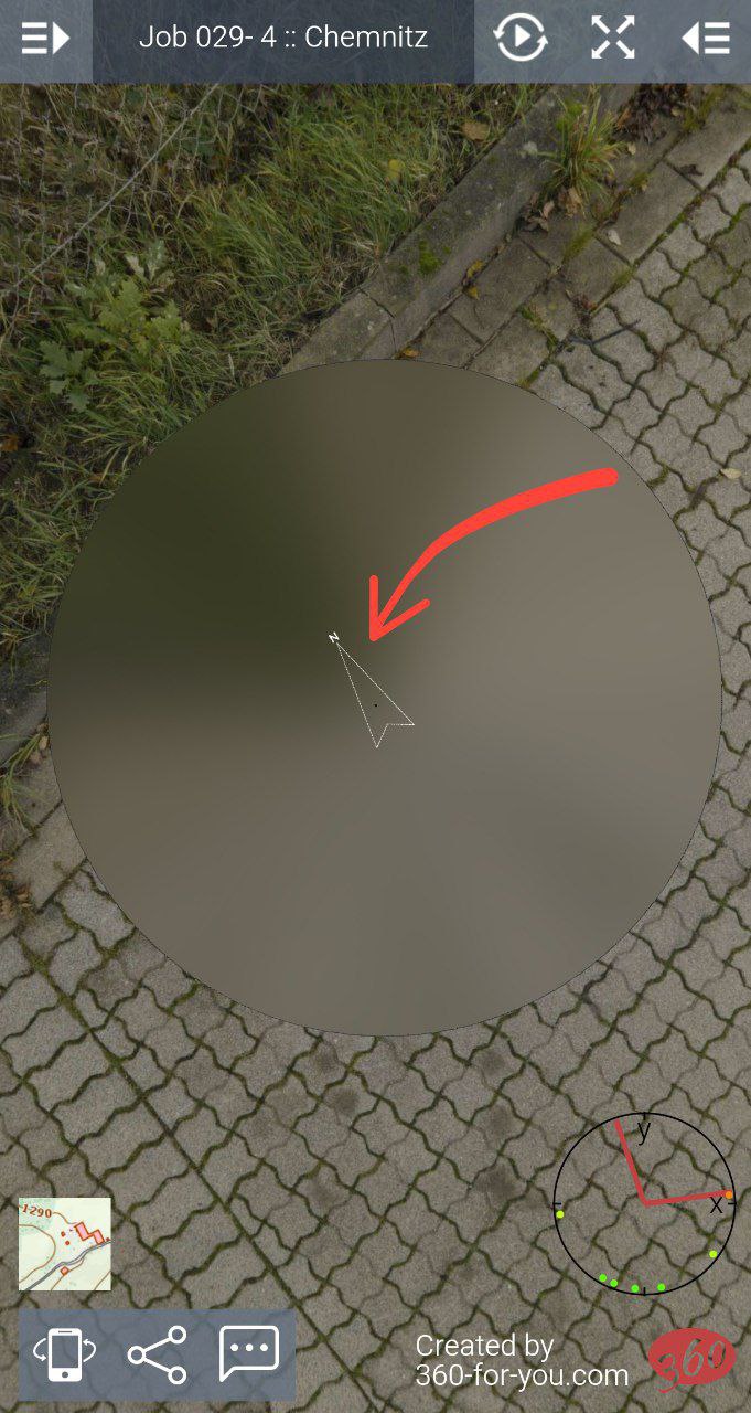
A new feature to add an arrow pointing north on panoramas