Noticias
2026-06-01
This March, we exhibited for the very first time. We came to show off our online viewer for virtual tours, point clouds, meshes, and 3D models. Over 3 days, we ran around 50 product demos.
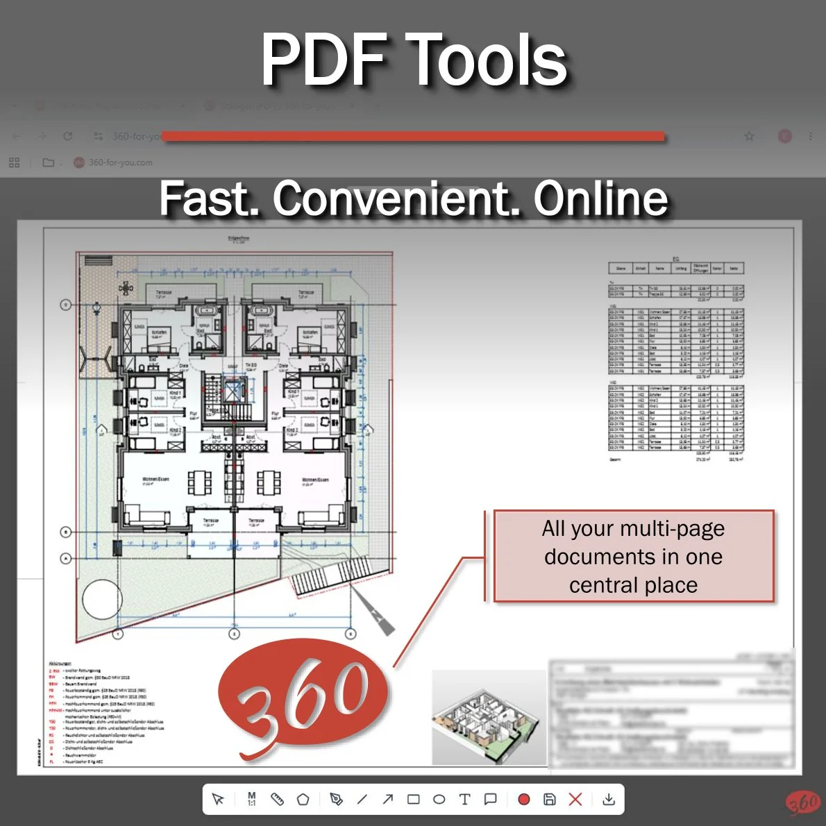
And the most common request? I'll be honest, it caught me off guard. It went something like this: "We need to upload PDFs to measure distances and areas."
Maybe it was because the Bluebeam booth was right next to ours? 🤔
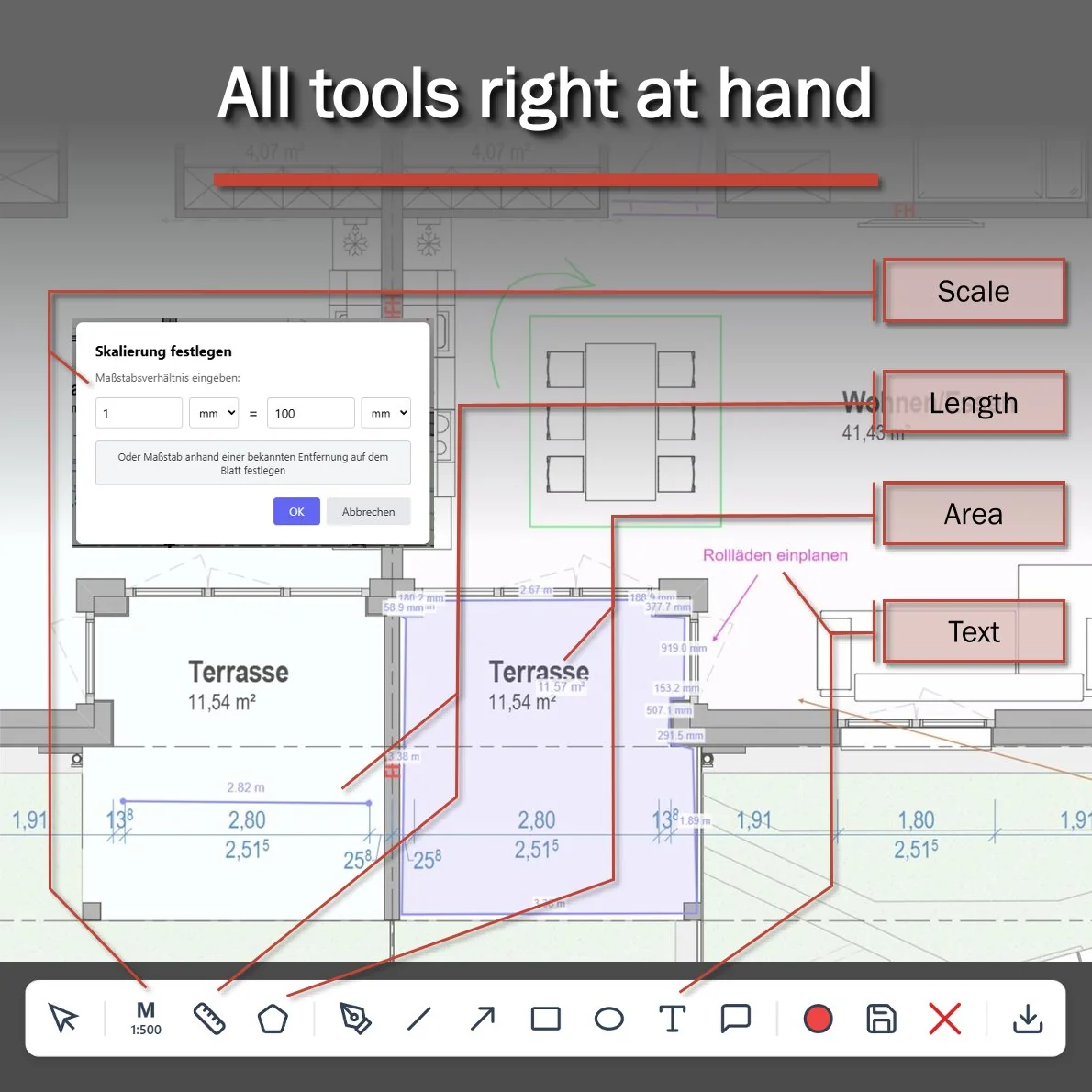
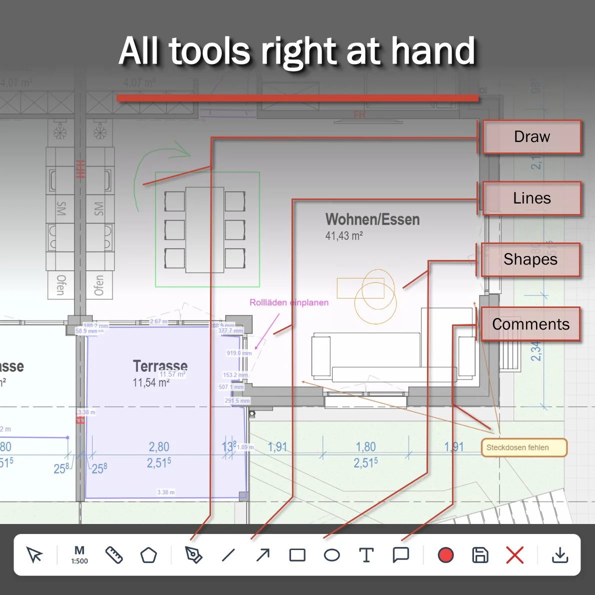
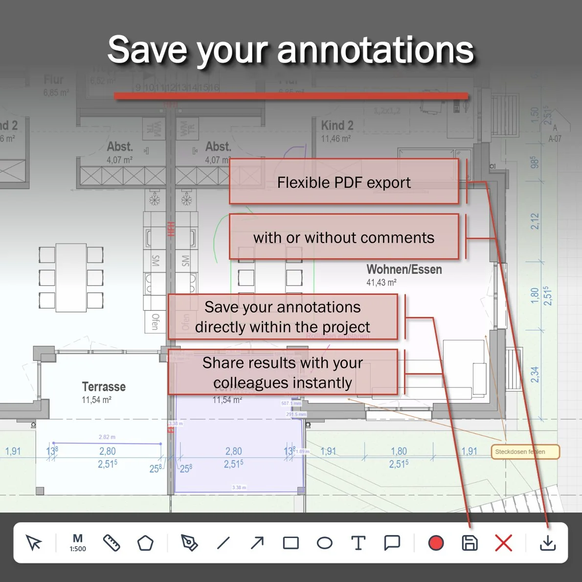
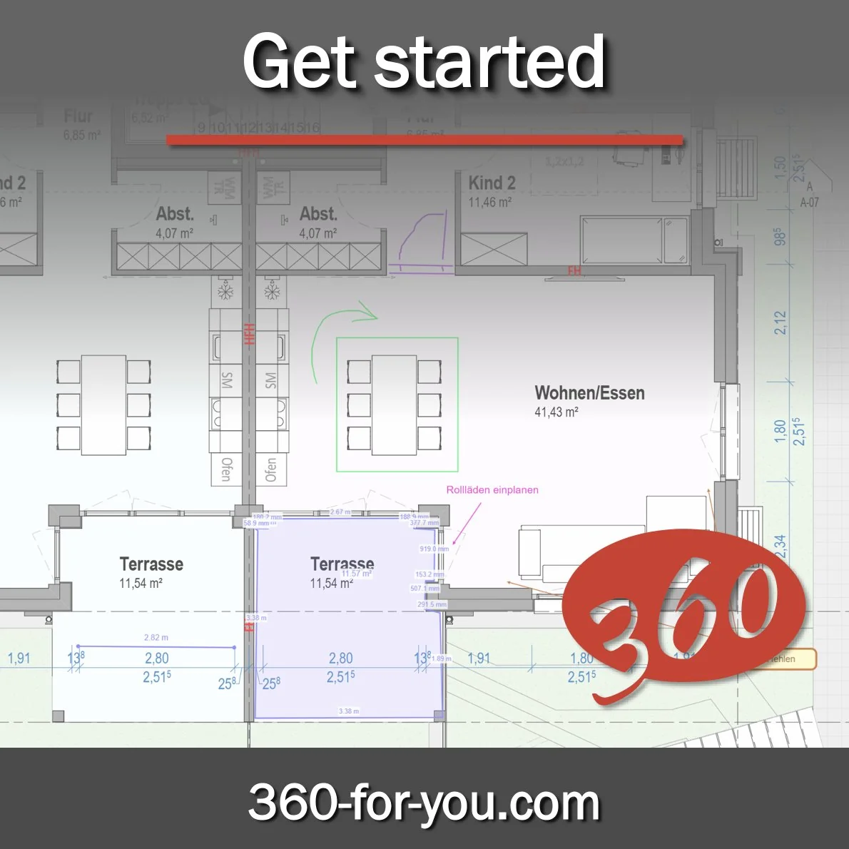
Either way, once the dust settled and I'd had a little rest, I sat down and built it: a clean, easy-to-use online PDF viewer with scaling, measurements, and annotations. You can save everything to the server or just download the file to your own drive. I'm really proud of how it turned out.
So now the 360-for-you family has a new data block. Here's everything the platform supports today:
📍 Virtual tours (auto-generated from any laser scan data)
☁️ Point clouds (literally every file format out there)
🧩 Meshes (OBJ, GLB, STL, and more)
✨ 3D Gaussian Splatting (PLY, SPZ, SPLAT, KSPLAT, SOG)
🏗️ 3D models (including RVT, IFC, and many others)
🎥 360° video with track-to-map linking
📄 PDFs with annotations
🗺️ GeoTIFF with KML/KMZ annotation support
And all of it runs beautifully on any computer or mobile phone.
For larger enterprises, we also offer a self-hosted version.